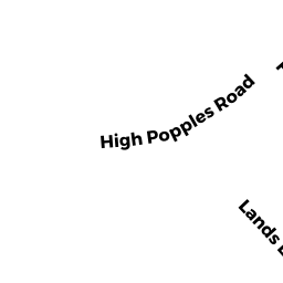
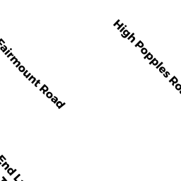
21 HIGH POPPLES RD
Owner Information
POLLARD BRIAN
21 HIGH POPPLES RD
GLOUCESTER, MA 01930-4266


Property Details
21 HIGH POPPLES RD is classified as a Multiple Houses on one parcel (Modern/contemp).
The primary structure on this property was built in 1971. There are 2,415ft2 of built area within this property. There is 1,876ft2 of residential/living space within this property.
21 HIGH POPPLES RD is valued at $565,100. The land is valued at $202,300 and the structures are valued at $356,100. There is an additional valuation of $6,700 on this property.
This property is in Zone R-20. Confirm with local Zoning Board authorities to ensure there are no overlays or other easements on this property.
21 HIGH POPPLES RD was last sold on Wednesday, December 7, 2011 for $245,000.
Assessment data from fiscal year 2022.
Flood Data
According to the FEMA National Flood Hazard Layer, this property does not appear to be in a flood zone. It may also be in an area not yet reviewed. Nonetheless, confirm this information prior to taking any action.
To view the flood hazards around this property, create a FEMA "Firmette" Map of the area around 21 HIGH POPPLES RD.
Broadband Internet Providers
| Provider | Type | Bandwidth (mbps) | |
|---|---|---|---|
| HughesNet | Satellite | 25 | 3 |
| GCI Communication Corp. | Satellite | 0 | 0 |
| Cape Ann Communications | Fixed Wireless | 20 | 20 |
| Comcast | Cable | 1000 | 35 |
| Verizon New England Inc. | DSL | 1 | 0 |
| Viasat Inc | Satellite | 100 | 3 |
| VSAT Systems, LLC. | Satellite | 2 | 1 |
Broadband service provider data from December 2020.
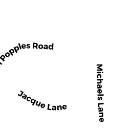
Adjacent Properties
- 5 MICHAELS LN
Two-Family Residential owned by TOBEY BRUCE H & GOLINI DOMINIC A TRS - 8 JACQUE LN
Single Family Residential owned by BUDROW MICHAEL H IV - 19 HIGH POPPLES RD #1
Residential Condominium owned by DEBBIE MARGUERITE & LAMURA VITO - 19 HIGH POPPLES RD #2
Residential Condominium owned by MCCARTHY CHRISTOPHER J & CHARLEEN T - 19 HIGH POPPLES RD
Other, Open Space owned by 19 HIGH POPPLES CONDO TRUST